Thursday, October 31, 2013

Alert for Long Island


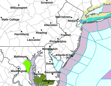
...WIND ADVISORY IN EFFECT FROM 6 AM TO 4 PM EDT FRIDAY...

THE NATIONAL WEATHER SERVICE IN NEW YORK HAS ISSUED A WIND
ADVISORY...WHICH IS IN EFFECT FROM 6 AM TO 4 PM EDT FRIDAY. THE
HIGH WIND WATCH IS NO LONGER IN EFFECT.

* LOCATIONS...SOUTHEAST CONNECTICUT AND EASTERN LONG ISLAND.

* HAZARDS...POSSIBLE DAMAGING WINDS.

* WINDS...SOUTHWEST 20 TO 25 MPH WITH GUSTS UP TO 50 MPH.

* TIMING...WINDS INCREASE TONIGHT...WITH THE STRONGEST WINDS
  EXPECTED FRIDAY MORNING INTO THE EARLY AFTERNOON.

* IMPACTS...STRONG SOUTHERLY WINDS MAY DOWN TREES AND POWER
  LINES...RESULTING IN SCATTERED POWER OUTAGES. THE STRONG WINDS
  MAY ALSO MAKE FOR DIFFICULT DRIVING FOR HIGH PROFILE VEHICLES.

PRECAUTIONARY/PREPAREDNESS ACTIONS...

A WIND ADVISORY IS ISSUED WHEN SUSTAINED WINDS OF 31 TO 39 MPH...
OR GUSTS OF 46 TO 57 MPH...ARE EXPECTED OR OCCURRING. WINDS THIS
STRONG CAN MAKE DRIVING DIFFICULT...ESPECIALLY FOR HIGH PROFILE
VEHICLES. USE EXTRA CAUTION.

Wet and windy weather system arriving soon for NJ metro

Latest post: 6:35pm -- 10/31/2013

Weather update:
The main part of the next system will be arriving toward morning...

Before this, some more showers are possible this evening and overnight, particularly in northwest New Jersey.
Winds become gusty reaching 15-20 mph, and somewhat higher over Long Island.


Tomorrow will see a steady rain in the morning, especially between 4am and 9am. Some left-over showers continue until around noon.
Rainfall amounts will range between 0.25" and 0.33". (One-quarter to one-third of an inch).
Winds can reach between 30-35mph, with some gusts to 40mph possible for all areas much of the day.


Highs tomorrow are expected range from the mid-60s at the coast, to between 70 and 75 degrees inland.
Some breaks in the clouds may be seen later in the afternoon.


The weather front is forecast to move away in time for the weekend.
More details for Saturday and Sunday in my next post.


6:10pm radar update

Northwest NJ the target in the next 30-60 minutes for some steady showers...

More showers for all of NJ metro after midnight.


2:15pm radar upate


Watching showers in Pennsylvania move east...

If this holds together, it will arrive in the Garden state between 6 and 7pm...


12:30pm radar update


Monmouth, Essex, Union, Hudson, and Bergen counties in NJ can see some light showers in the next 15 - 30 minutes.
Staten Island, as well as the 5 boroughs of New York City, will get wet in the next half hour or so, followed by Long Island between 1pm - 2pm.

A break in the wet weather appears likely just in time for the trick-or-treaters.
Temps will mainly be in the 60s.


11:30pm NJ radar update


Some light showers will be affecting Mercer, Warren, and Sussex counties in New Jersey in the next 30 to 60 minutes. Other northern NJ counties can see some light rain between 12:30pm and 1pm as well.


Thursday morning weather update for NJ metro

Latest post: 8:40am -- 10/31/2013


Weather update:
Clouds for sure will be around today...
Highs reach the mid- to upper 60s.

There are some showers moving through Pennsylvania.
They appear to be headed in the direction of northwestern New Jersey.

Future radar images will determine if the showers hold together and affect the above-mentioned area, as well as others in the NJ/NYC/Long Island metro region later today.

HAPPY HALLOWEEN!


Wednesday, October 30, 2013

Halloween updated forecast for NJ metro

Latest post: 6:10pm -- 10/30/2013


Partly cloudy tonight. Lows around 50 degrees.

** Trick-or-treaters will not need a jacket **
(Perhaps the umbrella for parts of the area).

A mostly cloudy day for Thursday ... with some breaks of sun possible.
There is a 30% chance of scattered showers during the daylight hours, particularly for northwestern NJ.  These showers, if they occur, are expected to be light in nature.
Temperatures top out in the mid- upper 60s in the afternoon.

A a 40% chance of showers exists for the same area mentioned above between 7pm and 9pm, with a 30% chance elsewhere. Temperatures during this time frame only fall back to between 63-65 degrees.
Rain becomes increasingly likely between 9pm (60%) and midnight (80%).

Friday will be wet in the morning, with some heavy downpours for the commute into work. Some lighter showers linger into the afternoon.  Highs top out around 70 degrees for many spots inland, with mid- 60s at the coast. It will be windy all day everywhere, with gusts reaching 35-40mph.

The weekend is expected to see a mix of sun and clouds. Saturday's highs reach the mid-60s. Sunday will be cooler and breezy, with highs in the 50s.

** Don't forget to set your clocks BACK one hour Saturday night ***


Wednesday afternoon update for NJ metro

Latest post: 12:05pm -- 10/30/2013


Some sprinkles about to end in southern New Jersey...

Clouds are lingering a bit longer than expected from my previous post, but should break for more of the area during the early to mid- afternoon.

Highs will reach 60 degrees in many spots.


A gray start to the day for NJ metro


Latest post: 8:40am -- 10/30/2013

Clouds will be clearing later this morning...
Some light rain in southern New Jersey ending by 11am.
Highs reach 60 degrees in the afternoon.


Tuesday, October 29, 2013

Tuesday evening weather update for NJ metro


Latest post: 7:30pm -- 10/29/2013

Clear early this evening, then clouds arrive tonight.
Lows by morning will be in the upper 30s to mid- 40s.

A mainly cloudy day on Wednesday. Some sprinkles or a light shower is possible, mainly in the morning. Afternoon highs top out around 60.

Halloween Thursday is expected to be mainly cloudy. Some scattered showers, light in nature, may arrive late in the day or by evening.
Highs reach the mid- 60s.
Thursday night will see a steady rain develop after midnight. Lows only fall back to around 60 degrees.

Friday is likely to see heavy rain in the morning, with some lighter showers in the afternoon. Highs get close to 70 degrees.

This next weather front should clear for the weekend, with partly sunny skies on Saturday, and highs in the 60s.
Marathon Sunday will be sunny, breezy, and cooler, with highs in the 50s.

More updates in the days to come.

** We turn the clocks BACK one hour Saturday night. **


Tuesday morning weather update for NJ metro

Latest post: 9:00am -- 10/29/2013


Today will likely be the brightest day until the weekend.
Sunshine is expected through the morning and afternoon.
Temperatures top out in the mid- 50s.
Tonight turns out clear and chilly, with lows in the upper 30s to the mid-40s.
Tomorrow will see clouds for the first part of the day.  There can be some sprinkles or a light shower. Highs reach between 55 and 60 degrees.

The next weather system arrives for the end of the week...
A warm front will first approach the area later on Thursday.
Some scattered showers are possible on Halloween afternoon, but should be light in nature.
Temperatures on Halloween reach the mid- 60s.
So, jackets under the trick-or-treaters' costumes will not be necessary.

A cold front will be the feature with this next weather system that provides our area with heavy rain after midnight Thursday night through Friday morning.
Some lighter showers will be around Friday afternoon.
Highs top out  between 65 and 70 degrees.

This weather front should clear for the weekend, with partly to mostly sunny skies. Temperatures top out in the 60s on Saturday, and in the 50s for Sunday.

Weather data this morning and afternoon will help with the forecast for Halloween, and an update will be posted by the end of the day.


Sunday, October 27, 2013

Alerts for parts of Long Island

URGENT - WEATHER MESSAGE NATIONAL WEATHER SERVICE NEW YORK NY 925 PM EDT SUN OCT 27 2013 NYZ078>081-280930- /O.NEW.KOKX.FR.Y.0010.131028T0600Z-131028T1300Z/ NORTHWESTERN SUFFOLK-NORTHEASTERN SUFFOLK-SOUTHWESTERN SUFFOLK- SOUTHEASTERN SUFFOLK- 925 PM EDT SUN OCT 27 2013 ...FROST ADVISORY IN EFFECT FROM 2 AM TO 9 AM EDT MONDAY... 

 THE NATIONAL WEATHER SERVICE IN NEW YORK HAS ISSUED A FROST ADVISORY...WHICH IS IN EFFECT FROM 2 AM TO 9 AM EDT MONDAY. * LOCATIONS...SUFFOLK COUNTY NY. * HAZARDS...AREAS OF FROST. * TEMPERATURES...IN THE MID 30S. * TIMING...LATE TONIGHT INTO EARLY MONDAY MORNING. * IMPACTS...SENSITIVE OUTDOOR PLANTS MAY BE KILLED IF LEFT UNCOVERED OR UNPROTECTED. PRECAUTIONARY/PREPAREDNESS ACTIONS... A FROST ADVISORY MEANS THAT FROST IS POSSIBLE. SENSITIVE OUTDOOR PLANTS MAY BE KILLED IF LEFT UNCOVERED. && $$

A cold start to Monday


2 products issued by NWS for:


Frost Advisory

URGENT - WEATHER MESSAGE
NATIONAL WEATHER SERVICE MOUNT HOLLY NJ
605 PM EDT SUN OCT 27 2013

NJZ012-013-020-022-023-281300-
/O.NEW.KPHI.FR.Y.0014.131028T0800Z-131028T1300Z/

MIDDLESEX-WESTERN 
MONMOUTH-OCEAN-ATLANTIC-CAPE MAY-
INCLUDING THE CITIES OF...NEW BRUNSWICK...FREEHOLD...JACKSON...
HAMMONTON...CAPE MAY COURT HOUSE
605 PM EDT SUN OCT 27 2013

...FROST ADVISORY IN EFFECT FROM 4 AM TO 9 AM EDT MONDAY... 

 THE NATIONAL WEATHER SERVICE IN MOUNT HOLLY HAS ISSUED A FROST
ADVISORY...WHICH IS IN EFFECT FROM 4 AM TO 9 AM EDT MONDAY.

* TEMPERATURES...MAINLY IN THE MID 30S TOWARD MORNING.

* TIMING...THE LIKELIHOOD FOR FROST AND NEAR FREEZING TEMPERATURES
  WILL INCREASE AS WE APPROACH SUNRISE ON MONDAY MORNING.

* IMPACTS...PROTECTIVE MEASURES MUST BE TAKEN TO PROLONG THE
  GROWING SEASON FOR SENSITIVE CROPS AND FLOWERS. THEY WILL
  LIKELY BE DAMAGED WITHOUT THESE MEASURES.

PRECAUTIONARY/PREPAREDNESS ACTIONS...

A FROST ADVISORY MEANS THAT FROST IS POSSIBLE. SENSITIVE OUTDOOR
PLANTS MAY BE KILLED IF LEFT UNCOVERED. IF NOT DONE SO ALREADY
BRING IN ANY PLANTS YOU WANT TO SURVIVE THE COLD SEASON. 


Sunday morning weather update for NJ metro

Latest post: 8:55am - 10/27/2013


Today will be mostly sunny with highs between 55 - 60 degrees.
Winds may be brisk at times, but not as gusty as on Saturday.

The general theme of the new work-week is milder, with highs in the 50s to around 60 degrees for Monday, Tuesday, and Wednesday.
There can be some rain by Wednesday.

A more important weather front arrives by Thursday or Friday, with a chance for more significant rain around this time.
Before this system arrives, afternoon temperatures are likely to reach the 60s.

Future model data will determine the timing and temperatures for the end of the week.


Saturday, October 26, 2013

A weather front approaches NJ metro

Latest post: 3:10pm -- 10/27/2013


Weather update: Clouds will move in tonight -- but the showers are forecast to stay north of our region, primarily affecting New England.

Tomorrow is expected to be mostly sunny.
The breeze will be lighter on Sunday, as temperatures top out between 55 and 60 degrees.


A gusty breeze for NJ metro today

Temperatures this afternoon will be a couple ofdegrees milder than yesterday, but a gusty wind is preventing the nicer feel to the bright sky...
The breeze will be lighter on Sunday, as temperatures top out between 55 and 60 degrees.

Not as cold in our future for NJ metro

Latest post: 9:25am -- 10/26/2013

Weather update:
If you survived the cold shivers the last couple of mornings... you are in luck!
The trend is for the next few nights to not be as cold, and afternoons to be milder!

More details soon.

Another cold night


Cold weather alerts for many areas in the northeast and middle Atlantic States for late tonight and early Saturday morning...

Frost advisory (Dark Blue)
Freeze Warning (Light Blue)

Friday, October 25, 2013

Friday afternoon weather update for NJ metro

Latest post: 12:55pm -- 10/25/2013


Weather update:
A partly to mostly cloudy Friday afternoon is in store...
Temperatures top out in the upper 40s in some northern and western suburbs to the lower 50s for the rest of the region.
A sprinkle is possible north and west of NYC.
A gusty breeze will blow from time to time.

Another cold night:
*** Frost advisories and freeze watches in effect for parts of New Jersey ***

...FREEZE WATCH REMAINS IN EFFECT FROM LATE TONIGHT THROUGH
SATURDAY MORNING...
MIDDLESEX-WESTERN MONMOUTH-MERCER-
INCLUDING THE CITIES OF...NEW BRUNSWICK...FREEHOLD...TRENTON

* TEMPERATURES...IN THE LOW 30S.

* IMPACTS...PLANTS AND CROPS MAY BE DAMAGED OR KILLED IF LEFT
  UNCOVERED THUS PUTTING AN END TO THE GROWING SEASON.
=========================================

...FROST ADVISORY REMAINS IN EFFECT FROM 4 AM TO 9 AM EDT
SATURDAY...

* LOCATIONS...SOUTHERN FAIRFIELD...SOUTHERN NEW HAVEN...SOUTHERN
  MIDDLESEX...SOUTHERN NEW LONDON...EASTERN PASSAIC...WESTERN
  BERGEN...WESTERN ESSEX...WESTERN UNION...ROCKLAND AND NORTHERN
  WESTCHESTER COUNTIES.

* HAZARDS...AREAS OF FROST.

* TEMPERATURES...IN THE MID 30S.

* TIMING...LATE TONIGHT INTO EARLY SATURDAY MORNING.

* IMPACTS...SENSITIVE OUTDOOR PLANTS MAY BE KILLED IF LEFT
  UNCOVERED OR UNPROTECTED.

Temperatures on Saturday afternoon reach the lower to mid-50s, with partly to mostly sunny skies.
Cloudy skies are expected Saturday night, with perhaps a sprinkle or light rain-shower.

Sunday will be milder, with highs between 55 and 60 degrees, along with a mix of sun and some clouds.

What will the new work-week bring? 
Details in my next post.


Thursday night weather update for NJ metro


Latest post: 11:10pm -- 10/24/2013


A cold night -- with many areas dropping to the freezing mark, and a few spots will wake up to readings in the upper 20s in northwestern NJ and Long Island.

Tomorrow will see a mix of sun and clouds, with highs between 50 and 55, along with a gusty breeze again.

A slow warm-up is expected over the weekend, with morning temperatures in the 30s and 40s, and highs mainly in the 50s, to possibly 60 degrees on Sunday.

Rain is not expected.

Wednesday, October 23, 2013

Light rain leaves, big drop in temperatures about to arrive for NJ metro


Latest post: 6:05pm -- 10/23/2013

Weather update:
Just about to arrive ... a cold drop in temperatures...

Some sprinkles and light rain moving through parts of New Jersey, which is likely to hold together and make it into NYC and at least parts of Long Island.
All rain chances should be over between 7 and 8pm.

Temperatures this evening will fall into the 40s.

Wake-up readings on Thursday are expected to range from the lower 30s in northwestern NJ and parts of Long Island, to the mid-30s for the rest of the Garden state, and 38-40 for the 5 boroughs of New York City.

Frost and freeze advisories are in effect from late tonight through early tomorrow morning...


Courtesy: NWS, Mount Holly, NJ

MORRIS-HUNTERDON-SOMERSET-
INCLUDING THE CITIES OF...MORRISTOWN...FLEMINGTON...SOMERVILLE
336 PM EDT WED OCT 23 2013

...FROST ADVISORY NOW IN EFFECT FROM 4 AM TO 9 AM EDT THURSDAY...
...FREEZE WATCH IN EFFECT FROM LATE THURSDAY NIGHT THROUGH FRIDAY
MORNING...

THE NATIONAL WEATHER SERVICE IN MOUNT HOLLY HAS ISSUED A FREEZE
WATCH...WHICH IS IN EFFECT FROM LATE THURSDAY NIGHT THROUGH
FRIDAY MORNING.

* TEMPERATURES...IN THE LOWER 30S SHOULD PRODUCE AREAS OF FROST.

* TIMING...NEAR DAWN THURSDAY.

* IMPACTS...PLANTS AND CROPS MAY BE KILLED IF LEFT UNCOVERED
  THUS PUTTING AN END TO THE GROWING SEASON.
--------------------------------------------------------


SUSSEX-CARBON-MONROE-
INCLUDING THE CITIES OF...NEWTON...JIM THORPE...STROUDSBURG
336 PM EDT WED OCT 23 2013

...FREEZE WARNING REMAINS IN EFFECT FROM 2 AM TO 9 AM EDT
THURSDAY...


* TEMPERATURES...IN THE LOWER 30S.

* IMPACTS...PLANTS AND CROPS WILL BE KILLED IF LEFT UNCOVERED
  THUS PUTTING AN END TO THE GROWING SEASON.

* CONFIDENCE...AVERAGE. ITS POSSIBLE SOME AREAS WILL ESCAPE
  FREEZING TEMPERATURES IF THERE IS A WIND STIRRING DURING THE
  PREDAWN HOURS.

* OUTLOOK...THE GROWING SEASON ENDS FRIDAY WHEN FROST OR FREEZE
  PRODUCTS ARE NO LONGER ISSUED THIS FALL FOR THIS AREA OF
  NORTHEAST PENNSYLVANIA AND FAR NORTHWEST NEW JERSEY.


Wednesday afternoon weather update for NJ metro

Latest post: 2:30pm -- 10/23/2013


Weather update:
Main weather feature to our south tracking out to sea.
The light rain in southern NJ is moving away.

Another weak disturbance to our west is touching off some sprinkles and light showers in northern and northwestern NJ, and could survive the trip east into the rest of NJ, NYC and Long Island during the course of the afternoon.

Rainfall totals will generally be one-tenth of an inch or less.

Colder air moves in tonight.


2:15pm metro NJ radar update


2:15pm metro NJ radar update
Some sprinkles or light showers are moving into northern and northwestern NJ...


11:15am radar update for NJ metro

Latest post: 11:15am -- 10/23/2013

Based on the latest radar images, and some new morning weather data, it is likely that the rain will primarily affect Monmouth county and points south in southern NJ, as well as Long Island.
The rest of NJ and NYC will only see some sprinkles, and could see the occasional break or two of sunshine.

Temperatures will generally be in the upper 40s to lower 50s. 

Another update will be posted if radar images show necessary.


New Cold Alerts for New Jersey


Frost and Freeze advisories in effect...

Courtesy: NWS, Mounty Holly, NJ

...SEVERAL NIGHTS OF POTENTIAL FROST OR FREEZING TEMPERATURES ARE
ON THE HORIZON FOR PORTIONS OF EASTERN PENNSYLVANIA AND NEW
JERSEY...

.HIGH PRESSURE WILL BEGIN TO SETTLE OVER THE REGION LATE TONIGHT
AS A COASTAL LOW PRESSURE MOVES AWAY FROM THE REGION. CLEARING
SKIES AND DECREASING WINDS SHOULD ALLOW FOR SEVERAL AREAS TO DROP
INTO THE MID-30S BY THURSDAY MORNING. PORTIONS OF THE POCONOS
COULD DIP BELOW FREEZING. TONIGHT IS THE FIRST NIGHT OF SEVERAL
WHERE CONDITIONS COULD PRODUCE MORE FROST AND FREEZE ISSUES.
-------------------------------------------------------------
..FROST ADVISORY REMAINS IN EFFECT FROM 2 AM TO 9 AM EDT
THURSDAY FOR:

MORRIS-HUNTERDON-SOMERSET-WESTERN CHESTER-WESTERN MONTGOMERY-
UPPER BUCKS-
INCLUDING THE CITIES OF...MORRISTOWN...FLEMINGTON...SOMERVILLE...
HONEY BROOK...OXFORD...COLLEGEVILLE...POTTSTOWN...CHALFONT...
PERKASIE


* IMPACTS...POTENTIAL DAMAGE TO SENSITIVE PLANTS AND CROPS IF
  LEFT UNCOVERED
-------------------------------------------------------
Freeze Watch in effect for late tonight through early Thursday morning for:

WARREN-BERKS-LEHIGH-NORTHAMPTON-
INCLUDING THE CITIES OF...WASHINGTON...READING...ALLENTOWN...
BETHLEHEM...EASTON

Freeze warning in effect for:
Sussex county in New Jersey from 2am - 9am Thursday

A FREEZE WARNING MEANS SUB-FREEZING TEMPERATURES ARE IMMINENT OR
HIGHLY LIKELY. THESE CONDITIONS WILL KILL CROPS AND OTHER
SENSITIVE VEGETATION.


Wednesday morning weather update for NJ metro


Latest post: 9:00am -- 10/23/2013

The cold front yesterday evening has resulted in readings in the 30s and 40s to begin the morning for our entire area.

A quick-moving weather system will be affecting most of the region today...
The wet weather has been down across southern New Jersey, and the Philadelphia metro area so far...

The models are in good agreement indicating  central, southern, and eastern sections of NJ, as well as Long Island, that have the best chance to get wet.
Rainfall amounts are expected to be light, ranging from one-tenth to one-quarter of an inch for the above-mentioned areas.
For northwestern and extreme northern NJ, including Sussex, Warren, and Passaic counties, as well as for NYC, only some sprinkles or light rain will fall respectively.
Highs today only top out in the upper 40s and lower 50s.
All rain opportunities will end late this afternoon or early evening, with the cold air getting re-enforced tonight...

Temperatures by morning on Thursday will be in the 30s in New Jersey and Long Island, to around 40 for NYC.  Some NJ and Long Island locations could drop into the upper 20s, ending the growing season.
New frost and freeze alerts are in effect, which I will post separately.

For Thursday, highs reach between 50 and 55 degrees for most spots, with partly, to occasionally, mostly cloudy skies. A few sprinkles are possible, mainly for northwestern New Jersey.

Another cold start on Friday, with temps. in the upper 20s to upper 30s. Sun and clouds will be mixed during the afternoon.
Highs on Friday reach around 50 degrees.

The chill continues over the weekend...

More details on this in my next post.


Temperature update

Latest post: 11:45pm -- 10/22/2013


Some areas in northwestern NJ have already dropped into the upper 30s -- with a few more degrees downward possible.

Some patchy frost can be expected.

Tuesday, October 22, 2013

Tuesday evening weather update

Latest post: 6:15pm -- 10/22/2013


The cold front is on schedule to bring colder air into the region beginning tonight...
During this process, a weather system will bring the area some wet weather on Wednesday.
This will not be a heavy rain-maker, and will be a fairly quick-mover.
Between one-tenth to one-quarter of an inch of rain (0.10" - 0.25") is expected.
The higher amounts are expected for coastal New Jersey and Long Island, with the lower amounts forecast for most of northwestern New Jersey. Sussex and Warren counties in the Garden state may see even less than one-tenth of an inch of rain.

The wet weather ends by mid- late afternoon.
Temperatures tomorrow may rise into the lower 50s early before falling back into the 40s.

The bigger weather story, as has been well-advertised, will be colder nights for Wednesday, Thursday, and Friday, where a freeze is possible, ending the growing season. Highs these days only top out in the upper 40s to lower 50s.

More details will be fine-tuned as the weather system gets organized. Radar images will help in determining the forecasted rainfall amounts.


Alert for New Jersey

Latest post: 4:30pm -- 10/22/2013

Courtesy: National Weather Service, Mount Holly, NJ


...SEVERAL NIGHTS OF POTENTIAL FROST OR FREEZING TEMPERATURES ARE
ON THE HORIZON FOR PORTIONS OF EASTERN PENNSYLVANIA AND NEW JERSEY...

.THURSDAY MORNING IS THE FIRST CHANCE FOR FREEZING TEMPERATURES
ALONG AND NORTH OF ROUTE 80. THE CHANCE FOR FREEZING TEMPERATURES
OR FROST INCREASES EARLY FRIDAY AND EARLY SATURDAY MORNING. ALSO...
THE POTENTIAL AREA OF COVERAGE OF FROST OR FREEZING TEMPERATURES
APPEARS LIKELY TO EXPAND SOUTHWARD INTO THE SUBURBS ALONG THE
INTERSTATE 95 CORRIDOR BY SATURDAY MORNING...TO JUST OUTSIDE OF
PHILADELPHIA.

NJZ001-PAZ054-055-230900-
/O.NEW.KPHI.FZ.A.0002.131024T0800Z-131024T1300Z/
SUSSEX-CARBON-MONROE-
INCLUDING THE CITIES OF...NEWTON...JIM THORPE...STROUDSBURG
330 PM EDT TUE OCT 22 2013

...FREEZE WATCH IN EFFECT FROM LATE WEDNESDAY NIGHT THROUGH
EARLY THURSDAY MORNING...

THE NATIONAL WEATHER SERVICE IN MOUNT HOLLY HAS ISSUED A FREEZE
WATCH...WHICH IS IN EFFECT FROM LATE WEDNESDAY NIGHT THROUGH
EARLY THURSDAY MORNING.

* LOCATIONS...THE SOUTHERN POCONOS OF NORTHEAST PENNSYLVANIA AND
  FAR NORTHWEST NEW JERSEY.

* TEMPERATURES...PROBABLY DROPPING INTO THE LOWER 30S.

* IMPACTS...POTENTIALLY ENDING THE GROWING SEASON FOR ANY
  REMAINING CROPS AND FLOWERS IN THIS AREA.

* CONFIDENCE: AVERAGE. THERE MAY BE ENOUGH CLOUD COVER AND WIND TO
  PREVENT A FREEZE OR FROST.

PRECAUTIONARY/PREPAREDNESS ACTIONS...

A FREEZE WATCH MEANS SUB-FREEZING TEMPERATURES ARE POSSIBLE.
THESE CONDITIONS COULD KILL CROPS AND OTHER SENSITIVE VEGETATION.

3:10pm radar update for NJ metro


The line of light showers has broken up into one or two areas -- one in stretching from Bergen county south into Essex and Union counties in New Jersey, and the other in Middlesex county southwestward into Mercer county.
This will be ending in the next 20 - 30 minutes for bother regions.

The sun is likely to come back out in the next 30 - 60 minutes.

The cold front will be crossing through this evening, likely without any rain, but the chill begins tonight...


Weather observations in the Garden state

As of 1pm -- 
It is 57 degrees at Sussex, New Jersey, with light rain ... and 72 degrees in Toms River, NJ, with sunshine...

It appears the best chance for some sprinkles or a light shower in the next hour or two is for central and northern New Jersey...


Tuesday morning weather update for NJ metro

Latest post: 11:15am -- 10/22/2013


The sun we have been enjoying this morning will fade to cloudiness moving in from Pennsylvania.
These clouds are in association with a cold front that will change our weather for the middle and end of this week.
A shower is possible at any point this afternoon and tonight as this front approaches and crosses through our area.
Highs today top out between 65 and 70 degrees.
Tonight's temperatures drop into the 50s this evening, to around 50  degrees overnight, and into the 40s by wake-up on Wednesday.

A colder air mass will already be felt by morning tomorrow. Skies are expected to be cloudy, as a weather disturbance comes close to the region. There remains uncertainty from the overnight and this morning's weather maps, but enough data appears to indicate at least some light rain from time to time. It is not out of the question that some wet snow-flakes can mix in, especially for northwestern New Jersey. Temperatures start out in the 50s, but will drop into the 40s during the course of the afternoon.
A gusty breeze will be felt as well.

Tomorrow night turns partly cloudy. Cold temperatures drop to between 40 and 45 degrees, with mid-30s in the suburbs.

Thursday and Friday begin with cold morning temperatures in the low to mid- 30s for most areas, which may put an end to the growing season. Afternoon temperatures on Thursday will be around 55 degrees, and only around 50 on Friday.
Skies will be partly to mostly cloudy, with some sprinkles possible, with even some flurries in northwestern NJ.

The weekend weather is not expected to change much, with cold morning, and chilly afternoons, with partly sunny skies.

Some milder weather may return by next week.

An update on rain chances for tomorrow will be posted this afternoon.


Temperatures on the way down for NJ metro -- will rain fall as well?

Latest post: 11:52pm -- 10/21/2013

Weather headache:
No, it's not the change in temperature later this week potentially causing a migraine ... 
Weather models tonight are not in agreement if a disturbance will move into our area, or go out to sea, causing difficulty in forecasting the outcome.

As of 11:45pm, two out of the three models predict that a path toward us is likely...
I would prefer to see the overnight data agree with the percentages...

As previously mentioned, temperatures will be tumbling by the time we get to the middle and end of the week.

An update on if it will be wet as well will be posted tomorrow.


Monday, October 21, 2013

Colder for sure... Will it rain this week?

Latest post: 10:45pm - 10/21/2013

Weather update:
Colder air a certainty for the middle and end of this week.

However, indication tonight that the next weather disturbance may stay offshore on Wednesday...


More data from additional weather models in the next hour will determine if there is more consensus of this...


Monday afternoon weather update for NJ metro


Latest post: 4:40pm -- 10/21/2013

Our area was able to enjoy sunshine with temperatures in the 60s today, with one or two locations touching 70 degrees this afternoon.
Tonight will become partly cloudy, with evening temperatures in the mid- to upper 50s.

Tomorrow morning starts out in the upper 30s in the suburbs, with most other areas between 45 and 50 degrees.
Similar highs are expected on Tuesday, but with more clouds in the sky.
** A strong cold front arrives tomorrow evening **
A sprinkle or light shower is possible as the front moves through.

Wednesday will be the first of several consecutive days of chilly weather...

Afternoon highs on Wednesday only top out the the 50s, and may drop during the afternoon into the 40s.
Rain is likely, particularly in the morning. If the precipitation lasts  into the afternoon, it is not out of the realm of possibility that some wet snow can mix in for the higher elevations of northwestern New Jersey.
A gusty breeze will be felt for much of the day.

Thursday and Friday are forecast to be partly to mostly cloudy.
Mornings start out in the 30s, where a freeze may end the growing season for some areas.
Some sprinkles are possible each afternoon. And, in northwestern NJ once again, some flurries may be around as well.
Highs on Thursday reach around 55 degrees, with temperatures on Friday only topping out in the upper 40s and lower 50s.

More updates soon.


Weather changes this week for NJ metro

Latest post: 9:20am -- 10/21/2013


Baby it's cold outside....

Many areas in the Garden state are starting off the day in the 30s...
Temperatures will warm up into the mid- 60s this afternoon.
Sunshine is expected from start to finish.

Skies are expected to be partly cloudy tonight -- with evening readings dropping through the 50s...
Wake-up temperatures on Tuesday will be in the upper 30s in the suburbs, with most other areas between 45 and 50 degrees.

** A strong cold front arrives Tuesday evening **
Before it arrives, clouds and sun will be mixed tomorrow, as highs top out in the mid- to upper 60s. There can be some sprinkles or a light shower later in the day or at night, as the front moves through.
Lows tomorrow night fall into the 40s.

Much cooler conditions begin on Wednesday. A weather disturbance will develop to our south, where the cold front is stalled, and move our way...
Rain is likely, especially in the morning. Highs on Wednesday stay in the 50s, along with a gusty breeze.

Thursday and Friday continue chilly -- along with partly to mostly cloudy skies. Temperatures top out around 55 degrees on Thursday, and only around 50 degrees on Friday.
There may be some scattered showers each afternoon -- and, in some higher elevations of northwestern New Jersey, and especially the Poconos and Catskills, some snow flurries are possible.

More updates later today.


Sunday, October 20, 2013

What can we expect weather-wise this week for NJ metro?

Latest post: 10/20/2013 -- 6:10pm 

Temperature tumble for the second half of the new work-week...

Clear skies, with temperatures dropping into the 50s this evening...
Wake-up readings will be in the 40s, with some upper 30s for northwestern NJ and parts of Long Island...

A mild Monday and Tuesday coming up, with highs mainly in the 60s.
** A strong cold front arrives Tuesday evening and Tuesday night ** Some scattered showers will be around.

More on the the much colder temperatures -- and perhaps, perhaps, the first mention of the 4-letter "S" word in October 2013 for parts of the area.

Details on when this may happen in my next post.


Saturday, October 19, 2013

8pm radar update for NJ metro


I just wanted to expand the time frame for a chance at a period of steady rain to between 9pm - 11pm.


7:20pm radar update for NJ metro

7:20pm radar update:
Some sprinkles and light rain has been falling in parts of the area...
The best time frame for a period of steady rain is between 9 and 10pm, primarily for northwestern sections of New Jersey.

Otherwise, the threat for more sprinkles/light rain continues for the area through midnight tonight.


5:10pm radar update for NJ metro


Northwestern NJ has the best chance of seeing some showers between 5:30 and 6pm...
Some sprinkles are also occurring over southwestern parts of the Garden state.

The rest of the area may see some showers between 8pm - 9pm, with all areas seeing the end of the threat for wet weather around midnight.


Saturday afternoon weather update for NJ metro

Weather update:
Temperatures have leveled off around 65 in most spots...
Clouds will be around for the rest of this afternoon and tonight -- with some scattered showers moving in between 7pm - 8pm. The chance for showers can continue until midnight.
Tomorrow is forecast to be mostly sunny and breezy, with highs around 65 degrees once again.

The general weather picture for the new work-week is a mild start -- with a strong cold arriving Tuesday night.
Rain chances are slim -- but a few showers are possible when this next front moves through.
Temperatures top out in the 60s for Monday and Tuesday --

Highs for Wednesday through Friday are likely to stay in the 50s with a gusty wind from time to time.
Partly to mostly cloudy skies through this period will make the fall chill feel gloomy at times as well.


Weekend weather update for NJ metro


Sunday will be the brighter of the two days...

Today will be mainly cloudy... Some scattered light showers can be around this evening, after 7pm or so, up until around midnight.
Temps. today reach the mid- to upper 60s.
Tonight's readings drop to between 60 and 65 degrees.

Tomorrow begins with temps in the upper 40s and lower 50s, with highs topping out around 65 degrees or so.
The day will feature plenty of sunshine, but a gusty breeze will be a nuisance at times.

A milder start to the work-week will be followed by some much cooler weather. 

Details on this, as well as if it will be a rain-free week, in my next post.


Any wet weather this weekend for NJ metro?

Weekend weather update:

Clear and chilly tonight. Temps. at wake-up time on Saturday in the mid-40s to around 50 degrees.
Saturday starts with sunshine -- but clouds arrive in the afternoon. A shower is possible in the evening or at night. Highs in the mid-60s.
Evening temperatures drop to around 60.
Overnight readings fall into the 50s.

Sunday will be mostly sunny and breezy.
Morning temps in the upper 40s to lower 50s.
Daytime highs reach around 65 degrees.

The new work-week starts of dry ...
Temperatures reach the upper 60s on Monday, with mainly sunny skies.
Similar highs are expected on Tuesday, with some scattered showers possible by late in the day or at night.

** A strong cold front crosses the area Tuesday night **
Wednesday turns out much cooler, with highs only mid- to upper 50s. Skies should be mostly sunny.
Thursday and Friday are expected to be partly to mostly cloudy -- with scattered rain-showers around, along with a brisk wind. Highs only between 50 and 55 degrees.

More updates on Saturday.


Friday, October 18, 2013

Special weather statement for NJ metro


Important weather information:
(Courtesy: National Weather Service)

Posted 8:55am -- 10/18/2013

A DRY AIR MASS WILL COMBINE WITH INCREASING WEST WINDS TO CREATE
CONDITIONS MORE CONDUCIVE FOR FIRE SPREAD INTO EARLY AFTERNOON.

RELATIVE HUMIDITY IS EXPECTED TO DECREASE TO 35 TO 45 PERCENT DURING
THIS TIME...WHILE WIND GUSTS INCREASE TO 20 TO 25 MPH. THESE
CONDITIONS WOULD LIKELY AID FIRE SPREAD IF IGNITION OCCURS.

11pm radar update for NJ metro


The weather disturbance will be making it's closest approach in the next hour or so --
Northwestern New Jersey has the best opportunity for some steady rain between 11pm and midnight, with some sprinkles or a light shower elsewhere in the Garden state.

Long Island will only see some sprinkles or a light shower between midnight and 1am.

The weather system clears the coast by 2am.


Thursday, October 17, 2013

9:10pm NJ metro radar update

Weather system on schedule...

Some light showers occurring over Nassau county on Long Island as of this post.

The "highest chance" for some additional showers will be between 11pm and midnight for New Jersey and between midnight and 1am for Long Island. 

The weather system will clear the coast by 2am Friday.


Thursday evening weather update for NJ metro


Below post: 6:30pm -- 10/17/2013

Weekend weather update:
Friday will be sunny and breezy. Highs top out in the upper 60s to around 70 degrees.

On Saturday, a cold front approaches the area...
Increasing clouds are expected in the afternoon, as temps reach the mid- to upper 60s.
Some scattered showers are possible Saturday night, but, the next front has similar characteristics to the one tonight, which weakened as it approached our area, so I do not expect much from the second front as well.

Sunday now looks cooler, but mainly sunny. Highs top out between 60 and 65 degrees, along with a brisk wind.

Monday and Tuesday turn milder again, with partly to mostly sunny skies. Temperatures reach between 65 and 70 degrees.

*** A much stronger cold front moves through Tuesday night, setting up a chilly second half of next week -- when highs may stay only in the 50s. ***